Fixed Stations

  Main variables list

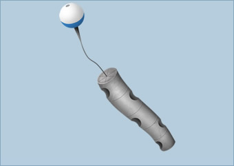
SOCIB FIXED STATIONS

This is a real-time monitoring system for obtaining reliable data relating to different oceanographic parameters (such as waves, currents, temperature and salinity) and also meteorological parameters (atmospheric pressure, wind speed or air temperature) through a network of infrastructures made up of coastal stations, oceanographic buoys, sea level stations and weather stations.

INNOVATION FOR IMPROVED FORECASTING


This network of fixed infrastructures with cutting-edge technology (based on innovation, control, constant maintenance and improvement thanks to the department of Engineering and Technological Development at SOCIB) represents a commitment to operational oceanography and constant improvement of the oceanographic forecasting systems.

THE MAIN BENEFITS OF THIS MONITORING:

Improved observation and forecasting of oceanic conditions (currents, waves...) which is crucial for improving maritime activities, both recreational and economic.

It helps to monitor water quality, to detect the acidification of sea water and aids the analysis of climate change.


Instruments

Oceanographic buoys

Are an increasingly important source of meteorological and oceanographic information.  They are deployed at sea with the objective of measuring parameters of oceanographic interest, such as marine currents, water temperature and wave measurements which become available in real time.  Thanks to the data being collected in time series it is possible to analyze past situations and develop forecasts.

HOW DO THEY WORK?

These buoys are moored to the seafloor so they maintain a constant position.  The instruments are divided between two locations, one set is submerged while the other set is located in the mast.  The meteorological instruments are located in the mast while the marine instruments are fixed, at a specific depth, inside the anchor cable.

For the data collection there is a data acquisition system, a wireless communication system and an onshore receiving station.

The power supply to the buoys comes from their photovoltaic panels which store energy in batteries to ensure the electronic equipment will be operational.

The buoys don´t measure waves one by one, they measure waves over a certain period of time.  This is because waves are an irregular phenomenon and successive waves will vary considerably in their height.  The measurements taken are then processed to obtain the parameters for height, period and direction of the waves, which are key aspects of the marine environment which together give rise to what is known as a "sea state."

Weather station

A weather station is a facility for regularly measuring and registering various meteorological variables.  This data is used both to learn about meteorological conditions and to aid numerical models for forecasting, as well as for specific studies relating to coastal fields of research.

HOW DO THEY WORK?

The SOCIB weather stations are made up of a base station and measuring sensors.  The sensors are fitted to an elevated point of the selected site by means of a meteorological mast.  Here the sensors log the data and collect information before transmitting it to the base station.  The advantage of these weather stations is that the data is stored locally and furthermore it can be checked and transmitted continuously.  

Sea level station

The main objective of these stations is to obtain sea level measurements.  This provides a high resolution time series of the variation of sea level at different points of interest, which can then be later analyzed by scientists.

HOW DO THEY WORK?

To take this measurement the station is equipped with a tide gauge to provide the pressure of the water mass and an atmospheric pressure sensor.  The combination of these two data is necessary to calculate the height of the water column above the water pressure sensor, by means of the hydrostatic equation.  By taking the position of the sensor as a reference point it is possible to obtain an absolute measure of sea level.

Costal stations

The coastal ecosystems are sensitive environments which have processes operating on different spatial and temporal scales.  Understanding these coastal processes and the response of coastal systems on all these scales is increasingly important.  Beaches are an element of great value because they are the first barrier to waves and coastal flooding as well as their economic and social relevance in terms of tourism and outdoor recreation.

WHAT DO THEY CONSIST OF?

Coastal monitoring is carried out via stations called MOBIMS (Modular Beach Integral Monitoring Systems).  MOBIMS consist of a video monitoring system, an Acoustic Doppler Current Profiler (ADCP) and a program for bathymetric mapping and sediment sampling.

This system provides real time data, images of the beach and the meteorological variables, as well as periodic information on waves, sediments and beach morphology.

This system enables data to be collected autonomously and continuously, it is then analyzed and stored so that it can be later used to observe and quantify the variability of the coastal zone.  Thanks to this a continuous data set  is obtained, with a long time series and high resolution of the coastal evolution, the waves and currents, the sediments and the beach topography, a key aspect for the correct characterization of the coastal ecosystems.